Like the Somerset Coal Canal and the Bude Canal, here is another remote and land-locked West Country waterway, which was visited by John while staying in West Somerset, but which is off limits to Patience without the help of a low-loader.
The Grand Western Canal currently runs 11 miles through the beautiful mid-Devon countryside, from Tiverton in the west to Loudwells at its eastern end. The Grand Western Canal was part of a planned 46 mile link from Topsham on the River Exe to Taunton, where it connected with the Bridgwater and Taunton Canal and, had it been completed through to Topsham, would have provided a link between the Bristol Channel and the English Channel. The Tiverton section opened in 1814 and for more than 100 years carried limestone from quarries at Holcombe to extensive lime kilns at Tiverton Basin, where quicklime was produced as a fertiliser. However, the section to Topsham was never built and by the mid 19th century the Tiverton to Taunton section was facing competition from Brunel's Great Western Railway. It finally closed in 1924.
In recent years, the 11 mile lock-free section from Tiverton to Loudwells has been restored by Devon County Council as part of a country park. A few private narrow boats and day boats use it, as does a wide-beam horse drawn trip boat, the 'Tivertonian'.
Near Manley bridge there is a memorial to the two-man crew of an RAF Canberra bomber, which crashed into the canal on 21 November 1961 while on a training flight from Germany.
Thursday, 28 April 2016
Tuesday, 26 April 2016
Still cold
We affirmed our belief that we are fair weather boaters by aborting a planned trip up the Leicester Arm due to bad weather. In intermittent heavy rain showers we did some basic maintenance, tanking up with water, disinfecting pipes and clearing air blocks while using the rain to scrub the rather grubby roof.
At a very good lunch at The Wharf (Welford) we agreed that the weather forecast (cold, sunny intervals broken by bands of rain, occasional light snow showers ...) wasn't attractive enough to entice us out, so we wrapped dear Patience up for another few weeks before we try to take her out again.
On an impulse we decided to go down to the museum at Stoke Bruerne (an hour by car - three days by boat!) and enjoyed the displays and the tea and cakes. A very friendly museum and a good spot near the Blisworth tunnel.
Last year we reached the Blisworth (north) end and opted not to continue to Stoke Bruerne as we were uncertain about moorings and turning. At 3,076 yards (2,813m) long it is the third-longest navigable canal tunnel on the UK canal network after Standedge Tunnel and Dudley Tunnel (and the ninth-longest canal tunnel in the world). On yesterday's inspection we need not have worried: there is extensive inline mooring and a good winding hole plus two pubs and two restaurants as well as the museum and café.
Here's the view of the lock - taken from the loading bay window of the old store that is now the museum. What appear to be two locks, one on either side of the central island is in fact one operating lock (on the left) and an old non-functioning one on the right.
Hailstones start falling heavily as I write this. A good decision to call off our trip.
At a very good lunch at The Wharf (Welford) we agreed that the weather forecast (cold, sunny intervals broken by bands of rain, occasional light snow showers ...) wasn't attractive enough to entice us out, so we wrapped dear Patience up for another few weeks before we try to take her out again.
On an impulse we decided to go down to the museum at Stoke Bruerne (an hour by car - three days by boat!) and enjoyed the displays and the tea and cakes. A very friendly museum and a good spot near the Blisworth tunnel.
Last year we reached the Blisworth (north) end and opted not to continue to Stoke Bruerne as we were uncertain about moorings and turning. At 3,076 yards (2,813m) long it is the third-longest navigable canal tunnel on the UK canal network after Standedge Tunnel and Dudley Tunnel (and the ninth-longest canal tunnel in the world). On yesterday's inspection we need not have worried: there is extensive inline mooring and a good winding hole plus two pubs and two restaurants as well as the museum and café.
Here's the view of the lock - taken from the loading bay window of the old store that is now the museum. What appear to be two locks, one on either side of the central island is in fact one operating lock (on the left) and an old non-functioning one on the right.
Hailstones start falling heavily as I write this. A good decision to call off our trip.
Wednesday, 10 February 2016
Railway Stations near Canals
Canals and rivers wend their way erratically across the country, not always reaching places that are convenient to access. Here is a solution - a map and a list of Railway Stations near canals.
We have found ourselves wanting to moor up in a pleasant spot but having no easy way of getting home or even of visiting a nearby town (though Ely, see pic, is an exception).
I used Google Earth to trace the canals we planned to visit, noting railway stations up to a mile or so away from where we might moor up. We could then take the train home for a few days or visit nearby towns for a change of scene. There are 2552 stations on the Network Rail network and I've identified 290 near canals and rivers in England and Wales.
I think Google Earth is magic. There are umpteen "layers" that sit on top of the satellite images and I was thrilled to find there is a layer showing canals and rivers. So I decided to create my own layer of "railways near canals." I'll explain here how to use it, and I hope you find it useful. It's certainly a work in progress, as for many areas I have no knowledge of the ground, so I rely on you to update me and correct my data for the benefit of all.
How to set up.
Open Google Earth, or download it from here.
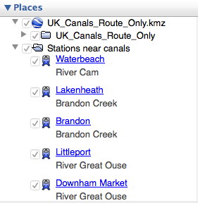
Now download the file "UK_Canals_Route_Only.kmz". Click on the three vertical dots on the right in the red header and select "Download kml".
Now import the file into your Google Earth sidebar:
(Menu: Open > and find where you saved your download)

Make sure it appears in your Layers sidebar and that it is ticked. Ticked layers are visible on the map, unticked layers are not. Untick anything you don't want to give more clarity leaving those you do want to see.
Now download the file "Stations_near_canals.kmz" in the same as you did for UK Canals Route, above.
Check that this appears in your Layers sidebar and tick it if necessary. Clicking on the little triangle to the left alternately opens the list up or closes it.
For clarity you may decide to switch off certain features such as 3D buildings, weather etc.
The selection for rail and waterways, already built in to Google Earth, is hidden in the "More" section (Layers > Primary Database > More) so open the lists by clicking on the triangle and ensure that both Rail and Waterway are ticked.
This clip shows the town of Rugby with a red dot, the railway-station-near-a-canal with a chunky blue train, a primary waterway in blue, a secondary waterway in bright green and the surrounding countryside in dark green. If you search for Rugby or click on the Rugby label in your Google Earth Places list you should see this and more!
Click on the chunky train icon to find out which canal is just a mile or so away and to get directions to and from that station.
to find out more about the line the railway is on and its destinations.
We have found ourselves wanting to moor up in a pleasant spot but having no easy way of getting home or even of visiting a nearby town (though Ely, see pic, is an exception).
I used Google Earth to trace the canals we planned to visit, noting railway stations up to a mile or so away from where we might moor up. We could then take the train home for a few days or visit nearby towns for a change of scene. There are 2552 stations on the Network Rail network and I've identified 290 near canals and rivers in England and Wales.
I think Google Earth is magic. There are umpteen "layers" that sit on top of the satellite images and I was thrilled to find there is a layer showing canals and rivers. So I decided to create my own layer of "railways near canals." I'll explain here how to use it, and I hope you find it useful. It's certainly a work in progress, as for many areas I have no knowledge of the ground, so I rely on you to update me and correct my data for the benefit of all.
How to set up.
Open Google Earth, or download it from here.
Now download the file "UK_Canals_Route_Only.kmz". Click on the three vertical dots on the right in the red header and select "Download kml".
Now import the file into your Google Earth sidebar:
(Menu: Open > and find where you saved your download)

Make sure it appears in your Layers sidebar and that it is ticked. Ticked layers are visible on the map, unticked layers are not. Untick anything you don't want to give more clarity leaving those you do want to see.
Now download the file "Stations_near_canals.kmz" in the same as you did for UK Canals Route, above.
Check that this appears in your Layers sidebar and tick it if necessary. Clicking on the little triangle to the left alternately opens the list up or closes it.
For clarity you may decide to switch off certain features such as 3D buildings, weather etc.
The selection for rail and waterways, already built in to Google Earth, is hidden in the "More" section (Layers > Primary Database > More) so open the lists by clicking on the triangle and ensure that both Rail and Waterway are ticked.
This clip shows the town of Rugby with a red dot, the railway-station-near-a-canal with a chunky blue train, a primary waterway in blue, a secondary waterway in bright green and the surrounding countryside in dark green. If you search for Rugby or click on the Rugby label in your Google Earth Places list you should see this and more!
Get Started. Now you have all the information you need to find railway stations near canals. Just browse the map using the tools at top right to zoom in and out and use your mouse to drag a route across the map.
to find out more about the line the railway is on and its destinations.
One other thing. The "Stations_near_canals.kmz" file can also be shown in a spreadsheet - stations_near_canals-data.xls . This shows just the unique name of the station and the nearby canal and you can search or arrange according to your needs. So you can now have a list of the nearby stations (usually within walking distance of a mile or so) for your chosen canal. Search for, or click on, the station name in Google Earth and you fly directly to it on the map, where more information can be found.
Caution: I can't guarantee the 100% accuracy of this data. Some of it is simple rule of thumb. What seems on the map to be just a hop and a skip away could mean a lengthy detour on the ground - and is that where you really want to moor up?
I'd encourage anyone who knows an area well to correct and amend to me, please, or in the comments box below. That way I can add to the list and we'll all find great mooring spots with railway stations nearby!
Postscript: There is now a Google Map site for canals and rivers. Open Canal Map doesn't specifically identify stations near canals but does show canals and rivers more clearly than the basic Google map. Try it at https://opencanalmap.uk/
Labels:
canals,
hub,
moorings,
rail,
railway,
railway stations,
train stations,
trains,
transport
Friday, 22 January 2016
Towpath Walks
I like boating. I like walking. What better occupation than to combine the two?
So I started by Googling “towpath walks” and visited the walking section of CRT. But there, at https://canalrivertrust.org.uk/enjoy-the-waterways/walking I’m told:
“We’ve previously hosted the details of a number of different walking and cycling routes. However, when we looked at them closely we weren’t convinced that all of our routes were completely accurate.”
They
then ask me to help identify and describe canal walks for them!So I started by Googling “towpath walks” and visited the walking section of CRT. But there, at https://canalrivertrust.org.uk/enjoy-the-waterways/walking I’m told:
“We’ve previously hosted the details of a number of different walking and cycling routes. However, when we looked at them closely we weren’t convinced that all of our routes were completely accurate.”
Now
at one level that might be a good project for me, but at the other level it
doesn’t get me very far in finding canal walks and aiming my boat in that
direction.
So I visited my usual walking site, Walking World. Finding the walks that use canals wasn’t obvious, but at last I stumbled on http://www.walkingworld.com/Articles/Pathways/Pathways/Canal-towpaths.aspx which has an excellent selection covering 32 counties or areas of the UK. I recommend that list, though you will need (inexpensive) http://www.walkingworld.com membership to view them.
What
other alternatives are there?
· You could wait until CRT’s collection of towpath walks is complete. Or perhaps
someone has stored the (admittedly out dated) walks from the British Waterways
site.
· You
could create your own using an OS map – though even where a circular route is
identified you can never be sure of how accessible (surface, nettles, width etc) the towpath will be.
· You
could also buy a book of well-researched walks. I have Weekend Walks by
Phillippa Greenwood and Martine O’Callaghan – an attractively photographed and
well laid out selection, though few walks in the east. You can usually buy walks locally
wherever there is a canal tea shop or chandlers. Julia Bradbury's books and TV programmes (also on DVD) are an excellent source.
· More
Googling shows Cool Canals with a useful list of canal walks which you’ll have
to Google again for more details (The Planekeeper’s Path, Somerset Space Walk)
and some free downloads.
I discovered useful suggestions
from the Long Distance Walkers Association (ldwa) site which has all sorts of publications and links.
For example, The Grand Union Canal Walk, http://www.grandunioncanalwalk.co.uk/
And Oxford Canal Walks : “A
walk connecting the cathedral cities of Oxford and Coventry using the
continuous canal towpath, passing 43 locks, many bridges, one tunnel and
crossing only one road.”
“A series of shorter walks, the North Oxfordshire Circular Walks, with distances varying up to 14 miles, have links to the Canal walk.”
I also found TowPath Treks, a site with walks on the Leeds and Liverpool canal.
“A series of shorter walks, the North Oxfordshire Circular Walks, with distances varying up to 14 miles, have links to the Canal walk.”
I also found TowPath Treks, a site with walks on the Leeds and Liverpool canal.
And
don’t forget that, using Google Earth, you can select the canal and river
option and use this as a guide to find walks near where you plan to be boating.
It won’t give you the walk but it will guide you to the canal-related area.
The
next step (ha!) is to decide how to walk it. Will you moor up, do the
circular walk then return to the boat? Or will you venture forth leaving your
boat at home? Or leave one person boating while the other walks alongside, to
meet up at the next lock?
I
think I prefer the moored boat, which is more relaxing and – assuming you
remember where you moored it – something pleasurable to come back to. Having
someone walk alongside the boat seems to me to create tension as to who is travelling
faster, so I find it best if the walker goes on ahead and waits for the boat by
the next lock or mooring place – which helps of course in locking through.
Any more suggestions for sources of good canal towpath walks?
Monday, 16 November 2015
Essential Equipment on your narrow boat
What is essential and what is merely convenient? Some things that seem not to be essential become so if there is an equipment failure or an unexpected problem.
Here's my attempt to describe the essentials. At the least it should provide you with a starter kit list.
I've divided the kit into food (dealt with in separate blog entry), tools (which may seem a very short list but could be almost endless), boat essentials, general and clothes.
Tools
multi-meter
standard tool kit including screw drivers (slotted, philips and electrical), adjustable spanners, gaffer tape, sealant, stanley knife, ptfe tape, bulbs, fuses, superglue, oil, pencil …
if using logs for fuel, include saw and axe; secateurs and a small folding saw are valuable for clearing overhanging branches
Boat Essentials
Much of this should be permanently on board - but check frequently to be sure and renew if necessary:
windlass
fuel, gas, water and wood
two long poles - one with a hook
keys - BW, starter, boat doors, pump-out - all on a float (and check that it does, indeed, float!)
water hose with connectors
dipsticks to measure water and fuel levels
spikes, piling hooks, club hammer (painted in bright colour so it doesn't get lost)
ropes for mooring, centre ropes long enough for solo boating, spare ropes,
spare light bulbs and tubes for internal and external lighting
painting gear with brushes, small sponge rollers, paint (bitumen, undercoat, top coat, anti rust, red oxide), sandpaper (wet and dry), white spirit, tins and jars
oil, WD-40, multi-purpose cleaner
fire extinguishers
first aid kit
guides and manuals
life jackets
life belt
head lamp
General
radio
phone
matches / lighter
brush, mop, bucket, sponge, environmentally friendly washing up liquid
loo roll, kitchen roll
torch
batteries and chargers for all devices
umbrella
suncream, polarising sunglasses, toiletries
binoculars, camera
blu tak, pen and paper, boat log, sellotape
pans, kettle, cutlery, sharp knives, bottle opener, mugs, plates, bowls
Clothes (in a flexible waterproof bag)
(I pack for the worst weather and am rarely disappointed ...)
two full sets of warm clothes
full set of waterproofs - trousers, jacket, hat, shoes or boots
cap with peak or brim
bedding - sheets, pillows, blankets, duvet/sleeping bag
Right, that's my list - what's yours?
Here's my attempt to describe the essentials. At the least it should provide you with a starter kit list.
I've divided the kit into food (dealt with in separate blog entry), tools (which may seem a very short list but could be almost endless), boat essentials, general and clothes.
Tools
multi-meter
standard tool kit including screw drivers (slotted, philips and electrical), adjustable spanners, gaffer tape, sealant, stanley knife, ptfe tape, bulbs, fuses, superglue, oil, pencil …
if using logs for fuel, include saw and axe; secateurs and a small folding saw are valuable for clearing overhanging branches
Boat Essentials
Much of this should be permanently on board - but check frequently to be sure and renew if necessary:
windlass
fuel, gas, water and wood
two long poles - one with a hook
keys - BW, starter, boat doors, pump-out - all on a float (and check that it does, indeed, float!)
water hose with connectors
dipsticks to measure water and fuel levels
spikes, piling hooks, club hammer (painted in bright colour so it doesn't get lost)
ropes for mooring, centre ropes long enough for solo boating, spare ropes,
spare light bulbs and tubes for internal and external lighting
painting gear with brushes, small sponge rollers, paint (bitumen, undercoat, top coat, anti rust, red oxide), sandpaper (wet and dry), white spirit, tins and jars
oil, WD-40, multi-purpose cleaner
fire extinguishers
first aid kit
guides and manuals
life jackets
life belt
head lamp
General
radio
phone
matches / lighter
brush, mop, bucket, sponge, environmentally friendly washing up liquid
loo roll, kitchen roll
torch
batteries and chargers for all devices
umbrella
suncream, polarising sunglasses, toiletries
binoculars, camera
blu tak, pen and paper, boat log, sellotape
pans, kettle, cutlery, sharp knives, bottle opener, mugs, plates, bowls
Clothes (in a flexible waterproof bag)
(I pack for the worst weather and am rarely disappointed ...)
two full sets of warm clothes
full set of waterproofs - trousers, jacket, hat, shoes or boots
cap with peak or brim
bedding - sheets, pillows, blankets, duvet/sleeping bag
Right, that's my list - what's yours?
Wednesday, 11 November 2015
General maintenance of a narrow boat
This is one in a series of A Guide to Narrow Boat Problems.
Problem
Poor maintenance leads to breakdowns and system failures
Causes
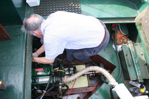
Poor maintenance could be carelessness or lack of skill and knowledge. I am fortunate in having a boating partner who is a very careful engineer. However if I was alone I'd have to invest more in learning some basic skills as well as employing an engineer for regular servicing. It simply can't be skipped.
Solutions
Maintenance is ongoing but can be divided into:
Every boat must have a current BSC - Boat Safety Certificate, renewed every four years. Most problems can be avoided by regular inspection and maintenance and the BSC reinforces that. Start with a thorough survey of the boat in dry dock by a qualified marine surveyor - local names and contact details are in waterways magazines and from your local marina. The £500 or so paid then could save you thousands if you avoid buying a boat with problems or you can forestall likely problems. It will also inform you of future tasks which could improve your boat's safety and comfort.
If you know what you are doing you will probably enjoy maintaining your boat in top condition. If your interest is more in the enjoyment of sun and water, birds and bridges, you may have to push yourself in to a basic routine and supplement this with regular maintenance by a qualified mechanic.
You might even decide to choose a marina on the basis of on site engineering facilities rather than lovely views and landscapes. You should then back that up with a subscription to Canal and River Rescue, the AA of boating.
Make sure you have the bottom of the boat blacked every 3 to 4 years and use this opportunity to check its condition.
Always wash hands after contact with canal or river water - see Weil's disease.
Be careful around moving parts and the heat of the exhaust. Whenever practical when dealing with or moving near the prop, ensure engine is turned off. For double certainty place keys in your pocket so no-one else can start the engine.
And don't venture alone into the water tank! It may need a layer of paint with potable bitumen but fumes and dust in a confined space can be hazardous. Who would hear your cries for help if you got stuck down there?
Several websites have detailed what should go on to your personal maintenance list so I'll refer you to them (below). We recommend creating a personalised handbook for your boat - it will provide information for anyone wishing to use your boat, will push you to answer questions and find out answers to be collected together (local phone numbers near your moorings, local shops and pub opening times as well as details of your boat's plumbing, what is always stored there and what should be removed in winterising ...). It would also list your regular and essential maintenance issues.
View these sites for more on regular maintenance:
Practical Narrowboat Maintenance
Boaters Handbook
Narrowboat Info
The Fitout Pontoon
Canal Junction
Problem
Poor maintenance leads to breakdowns and system failures
Causes
Poor maintenance could be carelessness or lack of skill and knowledge. I am fortunate in having a boating partner who is a very careful engineer. However if I was alone I'd have to invest more in learning some basic skills as well as employing an engineer for regular servicing. It simply can't be skipped.
Solutions
Maintenance is ongoing but can be divided into:
- continuous (battery levels, check engine noise etc),
- daily (bilges, weed hatch, grease gland etc),
- per journey (fuel levels, pump out, gas supply, food and water etc),
- monthly (pumps, oil, etc) and
- annual (winterising, anti-freeze, draining water etc).
Every boat must have a current BSC - Boat Safety Certificate, renewed every four years. Most problems can be avoided by regular inspection and maintenance and the BSC reinforces that. Start with a thorough survey of the boat in dry dock by a qualified marine surveyor - local names and contact details are in waterways magazines and from your local marina. The £500 or so paid then could save you thousands if you avoid buying a boat with problems or you can forestall likely problems. It will also inform you of future tasks which could improve your boat's safety and comfort.
If you know what you are doing you will probably enjoy maintaining your boat in top condition. If your interest is more in the enjoyment of sun and water, birds and bridges, you may have to push yourself in to a basic routine and supplement this with regular maintenance by a qualified mechanic.
You might even decide to choose a marina on the basis of on site engineering facilities rather than lovely views and landscapes. You should then back that up with a subscription to Canal and River Rescue, the AA of boating.
Make sure you have the bottom of the boat blacked every 3 to 4 years and use this opportunity to check its condition.
Always wash hands after contact with canal or river water - see Weil's disease.
Be careful around moving parts and the heat of the exhaust. Whenever practical when dealing with or moving near the prop, ensure engine is turned off. For double certainty place keys in your pocket so no-one else can start the engine.
And don't venture alone into the water tank! It may need a layer of paint with potable bitumen but fumes and dust in a confined space can be hazardous. Who would hear your cries for help if you got stuck down there?
Several websites have detailed what should go on to your personal maintenance list so I'll refer you to them (below). We recommend creating a personalised handbook for your boat - it will provide information for anyone wishing to use your boat, will push you to answer questions and find out answers to be collected together (local phone numbers near your moorings, local shops and pub opening times as well as details of your boat's plumbing, what is always stored there and what should be removed in winterising ...). It would also list your regular and essential maintenance issues.
View these sites for more on regular maintenance:
Practical Narrowboat Maintenance
Boaters Handbook
Narrowboat Info
The Fitout Pontoon
Canal Junction
Boat tilts in a lock
This is one in a series of A Guide to Narrow Boat Problems.
Problem
Boat tilts in a lock
Cause
Caught on cill (see Boat caught on a lock cill) or mooring rope is too tight.
Single handed boaters are most vulnerable as they will need to leave the boat tied up in a wide lock while they open the paddles. A longer than usual centre rope might help here, so the solo boater can hold on to the rope while attending to the lock mechanism. Failure to watch the centre rope and tying it too tightly will cause the boat to tilt - and tilting can lead to a serious danger.
Solution
There are three solutions:
Loosen centre rope, close paddles. In emergency cut centre rope.
If it is not yet an emergency untie the centre rope immediately.
Closing the paddles will decrease the urgency but will take a minute or so to take effect.
If the rope has been awkwardly wound or tied around a bollard it may now be too tight to undo, in which case cutting it may resolve the issue.
If you have crew, one person should deal with the rope while the other closes the paddles.
Avoidance
Crew must pay attention at all times in locks, whether on board or at the lock gates. Simply looping a rope once or twice round a bollard in a lock and crew holding it while paying it out, either on or off the boat, should suffice to keep it stable. For wide locks go in with another narrow boat. This will share the locking load and tend to keep the boats parallel.
Use the engine to keep the boat steady in the lock while watching for water surges. Open paddles slowly and in stages to minimise surges. Avoid a surge of water by opening the ground paddles gradually - ideally the paddle opposite the boat first, if there is only a single boat in the lock. You then reassess the situation before completely opening the ground paddles. Don't use the gate paddles until the boat is above their level. This should avoid water in your bow.
Be particularly careful if you have loads such as coal - or even passengers - on the roof, as this makes the boat less stable.
Use a Boatman's Hitch or a Round Turn and Two Half Hitches to moor up.
Single handed boaters might also consider an extended length of centre rope and carrying a sharp and stout knife for emergencies.
You don't want this to happen ...
Also for river boating think about your moorings in case of flood. Ideally you'll have a marina or a floating jetty to even out the highs and lows of water level. However if you are in an area likely to flood, care must be taken to allow for water levels, not tying moorings too tightly and placing mooring ropes at 45 degrees to the bank where possible. This allows the boat a little more flexibility to rise. This picture is from a boat that was moored on The Ouse at York in 2012.
Problem
Boat tilts in a lock
Cause
Caught on cill (see Boat caught on a lock cill) or mooring rope is too tight.
Single handed boaters are most vulnerable as they will need to leave the boat tied up in a wide lock while they open the paddles. A longer than usual centre rope might help here, so the solo boater can hold on to the rope while attending to the lock mechanism. Failure to watch the centre rope and tying it too tightly will cause the boat to tilt - and tilting can lead to a serious danger.
Solution
There are three solutions:
Loosen centre rope, close paddles. In emergency cut centre rope.
If it is not yet an emergency untie the centre rope immediately.
Closing the paddles will decrease the urgency but will take a minute or so to take effect.
If the rope has been awkwardly wound or tied around a bollard it may now be too tight to undo, in which case cutting it may resolve the issue.
If you have crew, one person should deal with the rope while the other closes the paddles.
Avoidance
Crew must pay attention at all times in locks, whether on board or at the lock gates. Simply looping a rope once or twice round a bollard in a lock and crew holding it while paying it out, either on or off the boat, should suffice to keep it stable. For wide locks go in with another narrow boat. This will share the locking load and tend to keep the boats parallel.
Use the engine to keep the boat steady in the lock while watching for water surges. Open paddles slowly and in stages to minimise surges. Avoid a surge of water by opening the ground paddles gradually - ideally the paddle opposite the boat first, if there is only a single boat in the lock. You then reassess the situation before completely opening the ground paddles. Don't use the gate paddles until the boat is above their level. This should avoid water in your bow.
Be particularly careful if you have loads such as coal - or even passengers - on the roof, as this makes the boat less stable.
Use a Boatman's Hitch or a Round Turn and Two Half Hitches to moor up.
Single handed boaters might also consider an extended length of centre rope and carrying a sharp and stout knife for emergencies.
You don't want this to happen ...
Also for river boating think about your moorings in case of flood. Ideally you'll have a marina or a floating jetty to even out the highs and lows of water level. However if you are in an area likely to flood, care must be taken to allow for water levels, not tying moorings too tightly and placing mooring ropes at 45 degrees to the bank where possible. This allows the boat a little more flexibility to rise. This picture is from a boat that was moored on The Ouse at York in 2012.
Labels:
avoidance,
causes,
disasters,
fault finding,
narrow boats,
problems,
sinking,
solutions
Subscribe to:
Posts (Atom)